RSC4Earth
RSC4Earth
Home
Mission
Team
Principle Investigators
Remote Sensing in Geo- and Ecosystem Research
Earth System Data Science
Remote Sensing Department at the UFZ
Geoinformatics and Remote Sensing
Support
Projects
Publications
Featured Publications
Recent Publications
Contact
Data
Sentinel
UAV Data as Alternative to Field Sampling to Map Woody Invasive Species Based on Combined Sentinel-1 and Sentinel-2 Data
Invasive plant species can pose major threats to biodiversity, ecosystem functioning and services. Satellite based remote sensing has …
Teja Kattenborn
,
Javier Lopatin
,
Michael Förster
,
Andreas Christian Braun
,
Fabian Ewald Fassnacht
Cite
DOI
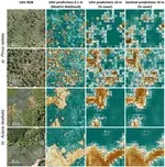
An Image Transform Based on Temporal Decomposition
Today, very dense synthetic aperture radar (SAR) time series are available through the framework of the European Copernicus Programme. …
Felix Cremer
,
Mikhail Urbazaev
,
Christian Berger
,
Miguel D. Mahecha
,
Christiane Schmullius
,
Christian Thiel
Cite
DOI
Cite
×