RSC4Earth
RSC4Earth
Home
Mission
Team
Principle Investigators
Remote Sensing in Geo- and Ecosystem Research
Earth System Data Science
Remote Sensing Department at the UFZ
Geoinformatics and Remote Sensing
Support
Projects
Publications
Featured Publications
Recent Publications
Contact
Data
Remote Sensing
Exploring Sentinel-2-Based Spectral Variability for Enhancing Grassland Diversity Assessments across Germany
Questions Can remote sensing data support the assessment of High Nature Value (HNV) conservation categories in the German HNV …
Antonia D. Ludwig
,
Hannes Feilhauer
,
Daniel Doktor
Cite
DOI
TEE Cube
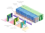
Time-varying AI-based mapping of ecosystem conditions and extents using multi-source Earth observation data cubes - TEE cube
PARSe Biodiversity
Biodiversity effects on Plant-Atmosphere interactions analysed with Remote Sensing (PARSe Biodiversity)
Cubo
Easily create EO mini cubes from STAC in Python.
Awesome Spectral Indices
A ready-to-use curated list of Spectral Indices for Remote Sensing applications.
Remote Sensing of Soil Moisture
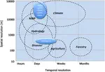
Soil moisture is an essential climate variable and knowledge about its state and dynamics is vital for numerous applications, from …
Alexander Gruber
,
Jian Peng
Cite
DOI
The Leaf Is Always Greener on the Other Side of the Lab: Optical in-Situ Indicators for Leaf Chlorophyll Content Need Improvement for Semi-Natural Grassland Areas
Leaf chlorophyll content (LCC) is an important indicator of plant health. Earth observation facilitates LCC monitoring on large spatial …
Antonia D. Ludwig
,
Daniel Doktor
,
Reimund Goss
,
Severin Sasso
,
Hannes Feilhauer
Cite
DOI
Transfer Learning from Citizen Science Photographs Enables Plant Species Identification in UAV Imagery
Accurate information on the spatial distribution of plant species and communities is in high demand for various fields of application, …
Salim Soltani
,
Hannes Feilhauer
,
Robbert Duker
,
Teja Kattenborn
Cite
DOI
A Roadmap for High-Resolution Satellite Soil Moisture Applications -- Confronting Product Characteristics with User Requirements
Soil moisture observations are of broad scientific interest and practical value for a wide range of applications. The scientific …
Jian Peng
,
Clement Albergel
,
Anna Balenzano
,
Luca Brocca
,
Oliver Cartus
,
Michael H. Cosh
,
Wade T. Crow
,
Katarzyna Dabrowska-Zielinska
,
Simon Dadson
,
Malcolm W.J. Davidson
,
Patricia De Rosnay
,
Wouter Dorigo
,
Alexander Gruber
,
Stefan Hagemann
,
Martin Hirschi
,
Yann H. Kerr
,
Francesco Lovergine
,
Miguel D. Mahecha
,
Philip Marzahn
,
Francesco Mattia
,
Jan Pawel Musial
,
Swantje Preuschmann
,
Rolf H. Reichle
,
Giuseppe Satalino
,
Martyn Silgram
,
Peter M. Van Bodegom
,
Niko E.C. Verhoest
,
Wolfgang Wagner
,
Jeffrey P. Walker
,
Urs Wegmüller
,
Alexander Loew
Cite
DOI
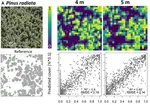
Convolutional Neural Networks Accurately Predict Cover Fractions of Plant Species and Communities in Unmanned Aerial Vehicle Imagery
Abstract Unmanned Aerial Vehicles ( UAV ) greatly extended our possibilities to acquire high resolution remote sensing data for …
Teja Kattenborn
,
Jana Eichel
,
Susan Wiser
,
Larry Burrows
,
Fabian E. Fassnacht
,
Sebastian Schmidtlein
Cite
DOI
»
Cite
×